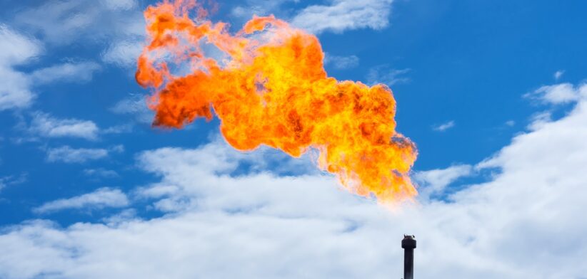
More than half of Australia’s methane “hotspots” are in Queensland’s Bowen Basin, with new data showing current national emissions levels may be twice as much as reported.
The Superpower Institute (TSI), a not-for profit organisation advocating for emissions reduction, has released a list of Australia’s top 20 methane hotspots, based on new satellite data.
TSI Chief Scientist Professor Peter Rayner said the list was compiled from observations by a new online tool, Open Methane, that used satellite technology to measure methane emissions at a 10x10km resolution across Australia.
Professor Rayner said satellite technology, already used in comparable countries around the world, offered a more accurate and detailed assessment of methane emissions compared to Australia’s existing estimation methods.
“Currently, Australia’s National Greenhouse and Energy Reporting Scheme (NGERS) relies on self-reported data from major emitters, using emissions factors based on activity levels like the amount of coal mined, or on sparse and nontransparent local measurements,” he said.
“This approach creates significant risk of inaccuracy.”
Professor Rayner said Open Methane demonstrated how satellite-based measurements, when combined with ground-based verification, could provide a clearer picture of actual emissions.
He said preliminary results estimated that methane emissions may be around double what was currently being reported.
“These initial results suggest that fossil fuel sites may be significantly underreported under the current NGERS framework.
“These findings underscore the urgent need for Australia to adopt independent methods in its emissions reporting to ensure more reliable data for its greenhouse gas inventory.”
Prof Rayner said methane was a potent greenhouse gas and understanding where it was coming from was essential to addressing global warming.
“Of the country’s 20 highest emitting locations, all are sites involving significant coal or gas extraction. This underscores the significant role of the fossil fuel sector in Australia’s methane emissions and highlights where we can make the most impact in reducing them.”
He said Open Methane results also indicated that emissions from several coal seam gas (CSG) sites may also be higher than previously expected.
“These findings challenge long-held assumptions about the primary sources of Australia’s methane emissions. While further validation is required, the data suggest that the coal and gas sectors – not agriculture – are the dominant contributors of anthropogenic emissions.”
Australia’s top methane-emitting hotspots identified by Open Methane (January–June, 2023):
- Winchester, QLD (Bowen Basin).
- Blackwater, QLD (Bowen Basin).
- Boggabri, NSW (Gunnedah Basin).
- Muswellbrook, NSW (Hunter Valley).
- Morwell, VIC (Latrobe Valley).
- Bundoora, QLD (Bowen Basin).
- Crinum, QLD (Bowen Basin).
- Coppabella, QLD (Bowen Basin).
- Condamine, QLD (Surat Basin).
- Narrabri, NSW (Gunnedah Basin).
- Albinia, QLD (Bowen Basin).
- Clermont, QLD (Bowen Basin).
- Newlands, QLD (Bowen Basin).
- Strathfield, QLD (Bowen Basin).
- Springvale, NSW (Sydney Basin).
- Hail Creek, QLD (Bowen Basin).
- Appin, NSW (Sydney Basin).
- Moranbah, QLD (Bowen Basin).
- Belyando, QLD (Galilee Basin).
- Helensburgh, NSW (Sydney Basin).