The Sunshine Coast’s spaces just got a whole lot more accessible with a new round of mobility mapping at Palmwoods, Buderim, Woombye and Landsborough.
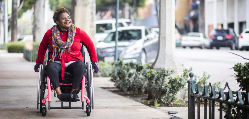
Wheelchairs with specially trained “pilots” and tracking devices are mapping how easy or hard council areas are to access for those in wheelchairs, pushing prams, using mobility aids, or with vision impairment.
Experts from Briometrix have been engaged to do the mapping, and the information will be incorporated into Sunshine Coast Council’s mobility maps and help inform footpath refurbishment and upgrades to improve accessibility.
The Mobility Map project began three years ago and was named 2022 Productivity through Infrastructure Award Winner in the National Awards for Local Government.
The areas mapped to date are Alexandra Headland, Beerwah, Birtinya (Sunshine Coast University Hospital and Kawana Stadium), Buddina, Caloundra, Coolum, Cotton Tree, Currimundi, Kawana, Maleny, Maroochydore, Montville, Mooloolaba and Nambour.
Sunshine Coast Council Strong Community Portfolio and Division 10 Councillor David Law said the revolutionary project was making life easier for people of all abilities.
“The mobility maps provide easy wayfinding information for all in our community, including those with toddlers in tow, the elderly, people using wheelchairs, mobility aids and the vision impaired,” Cr Law said.
“The maps are easy to use on your computer or handheld device, so you can check accessible parking locations, transport stops, toilet and changing facilities, even things like entries into restaurants, hotels and other attractions, boardwalks, beach mats, lift locations, as well as finding the best route between them.
“Equity and inclusion are key principles of our Council’s values, which is why this project is essential in identifying accessible routes suitable for everyone.
“While many people can simply decide to visit a new place and just go, those living with limited mobility face so many challenges that make it too difficult to contemplate visiting somewhere new.
“Mobility maps give them the tools to plan and be confident for a successful trip to a new place and experience.
“Our mobility maps are easy to use and help ensure that no matter what age, ability or mobility, everyone has the opportunity to enjoy all that our beautiful region has to offer.”
Find your best path, according to your needs and ability on the Council’s website.
The Council has also joined forces with local technology company Cérge, to improve access and inclusion for Council spaces that showcase arts, entertainment, environmental activities, sport and recreation.
A series of accessible tools have been developed so people can “know before they go” and understand venue accessibility ahead of time.
These can include a 360-degree Virtual Tour, Visual Story & Sensory Guide and Audio Guide.
Cérge has also connected with Council’s Accessible Beach program and very soon a “visual story” will be available to illustrate where and how to book and collect a beach wheelchair, how to use it and what to do on return.
“We are moving through our community and sport venues to help make our Council venues more accessible thanks to this partnership with a forward-thinking local business,” Cr Law said.
“This is a significant step towards becoming more inclusive as our region prepares to host inclusive sports events like the Australian Deaf Games in 2026, Union Cycliste Internationale (UCI) Para-cycling Road World Championships in 2028 and the Brisbane 2032 Olympic and Paralympic Games.”