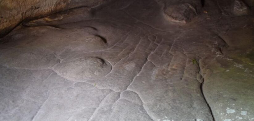
A 13,000-year-old engraving discovered near Paris is believed to be the world’s oldest 3D map.
Researcher Anthony Milnes, from the University of Adelaide, said a miniature representation of the surrounding landscape was found in a rock shelter in the Paris Basin, known since the 1980s for its ancient artistic engravings.
Dr Milnes, who was part of a European-led team, said new research suggested that part of the floor of the sandstone shelter, which was shaped and adapted by Palaeolithic people around 13,000 years ago, was modelled to reflect the region’s natural water flows and geomorphological features.
“What we’ve described is not a map as we understand it today — with distances, directions, and travel times — but rather a three-dimensional miniature depicting the functioning of a landscape, with runoff from highlands into streams and rivers, the convergence of valleys, and the downstream formation of lakes and swamps,” he said.
“For Palaeolithic peoples, the direction of water flows and the recognition of landscape features were likely more important than modern concepts like distance and time.”
Dr Milnes said their study demonstrated that human modifications to the hydraulic behaviour in and around the shelter extended to modelling natural water flows in the landscape in the region around the rock shelter.
“These are exceptional findings and clearly show the mental capacity, imagination and engineering capability of our distant ancestors.”
Read the full report: Palaeolithic map engraved for staging water flows in a Paris Basin shelter.


