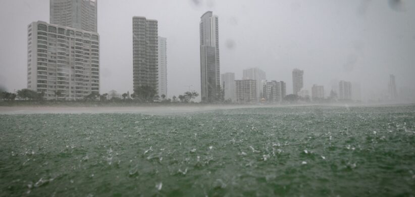
The chance of increased rainfall later this year has increased with the Bureau of Meteorology moving to a La Niña watch.
Bureau of Meteorology Climate Manager Dr Karl Braganza said while conditions in the tropical Pacific Ocean were currently neutral, there were some signs that a La Niña may form in the Pacific Ocean later in 2024.
“It is important to note, however, that there is a similar likelihood that the tropical Pacific Ocean will remain neutral,” Dr Braganza said.
He said moving to a La Niña watch did not mean that the Bureau was declaring a La Niña event, which typically brings significant rainfall to the east coast of Australia.
“The best guidance for future rainfall or temperature forecasts is the Bureau’s long-range forecast.
“The long-range forecast for June to August is showing an increased chance of above average rainfall for parts of eastern Australia.
“There are roughly equal chances of above or below median rainfall for most of eastern Australia, including much of Queensland, New South Wales, Victoria and Tasmania,” he said.
Dr Braganza said June to August maximum and minimum temperatures were very likely to be above median across all States and Territories.