A new tool has the ability to give robots superhuman vision by using Artificial Intelligence (AI) to transform radio waves into vivid 3D views of the environment.
Researchers at the University of Pennsylvania set out to tackle the challenge of developing robotic perception systems to operate in bad weather and other harsh conditions.
Assistant Professor Mingmin Zhao said traditional, light-based vision sensors, such as cameras or LiDAR (Light Detection And Ranging) failed in heavy smoke and fog.
Assistant Professor Zhao said the team looked to nature, where many animals had evolved ways to perceive their environment without relying on light.
He said radio waves could better penetrate smoke and fog, and even see through certain materials, all capabilities beyond human vision.
“Yet robots have traditionally relied on a limited toolbox.
“They either use cameras and LiDAR, which provide detailed images but fail in challenging conditions, or traditional radar, which can see through walls and other occlusions but produces crude, low-resolution images.”
Assistant Professor Zhao said their new senor, PanoRadar, leveraged radio waves and artificial intelligence (AI) to let robots navigate even the most challenging environments, like smoke-filled buildings or foggy roads.
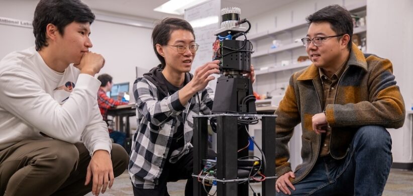
“PanoRadar is a sensor that operates like a lighthouse that sweeps its beam in a circle to scan the entire horizon.
“The system consists of a rotating vertical array of antennas that scans its surroundings. As they rotate, these antennas send out radio waves and listen for their reflections from the environment, much like how a lighthouse’s beam reveals the presence of ships and coastal features.”
He said by using AI, PanoRadar went beyond simple scanning.
“Unlike a lighthouse that simply illuminates different areas as it rotates, PanoRadar cleverly combines measurements from all rotation angles to enhance its imaging resolution.
“While the sensor itself is only a fraction of the cost of typically expensive LiDAR systems, this rotation strategy creates a dense array of virtual measurement points, which allows PanoRadar to achieve imaging resolution comparable to LiDAR.
“The key innovation is in how we process these radio wave measurements.”
Read the full paper: Enabling Visual Recognition at Radio Frequency


